Cirrus SR20 G6 N977JW Trade-In (February 2026)
Trip from Napa Airport (KAPC) to McGhee Tyson Airport, Knoxville, TN (KTYS)
Diary
2026-02-21: KAPC to KBFL
The initial leg of N977JW's last voyage started with a Napa (KAPC) departure on an IFR flight plan to Bakersfiled (KBFL). The trip was flown at 9,000' MSL. It was a beautiful day to fly with no clouds, and only a slight headwind.
- Departure: KAPC (Napa, CA), field elevation: 36'
- Arrival: KBFL (Bakersfield, CA), field elevation: 510'
- Hobbs Time: 2.2 hours
- Highest Flight Altitude: 9,000'
- Date/Time: 2026-02-21, 7:14AM to 9:10AM (PST)
- Approach: ILS RWY 30R @ KBFL
- Fuel: $7.11 per gallon @ KBFL
- ForeFlight Track Log
- C: KBFL
- R: MER3, Right Turn HDG 130, RV, MOD, EHF
- A: 5,000', expect 9,000' after 5 minutes
- F: 127.8
- T: 3637

2026-02-21: KBFL to KSDL
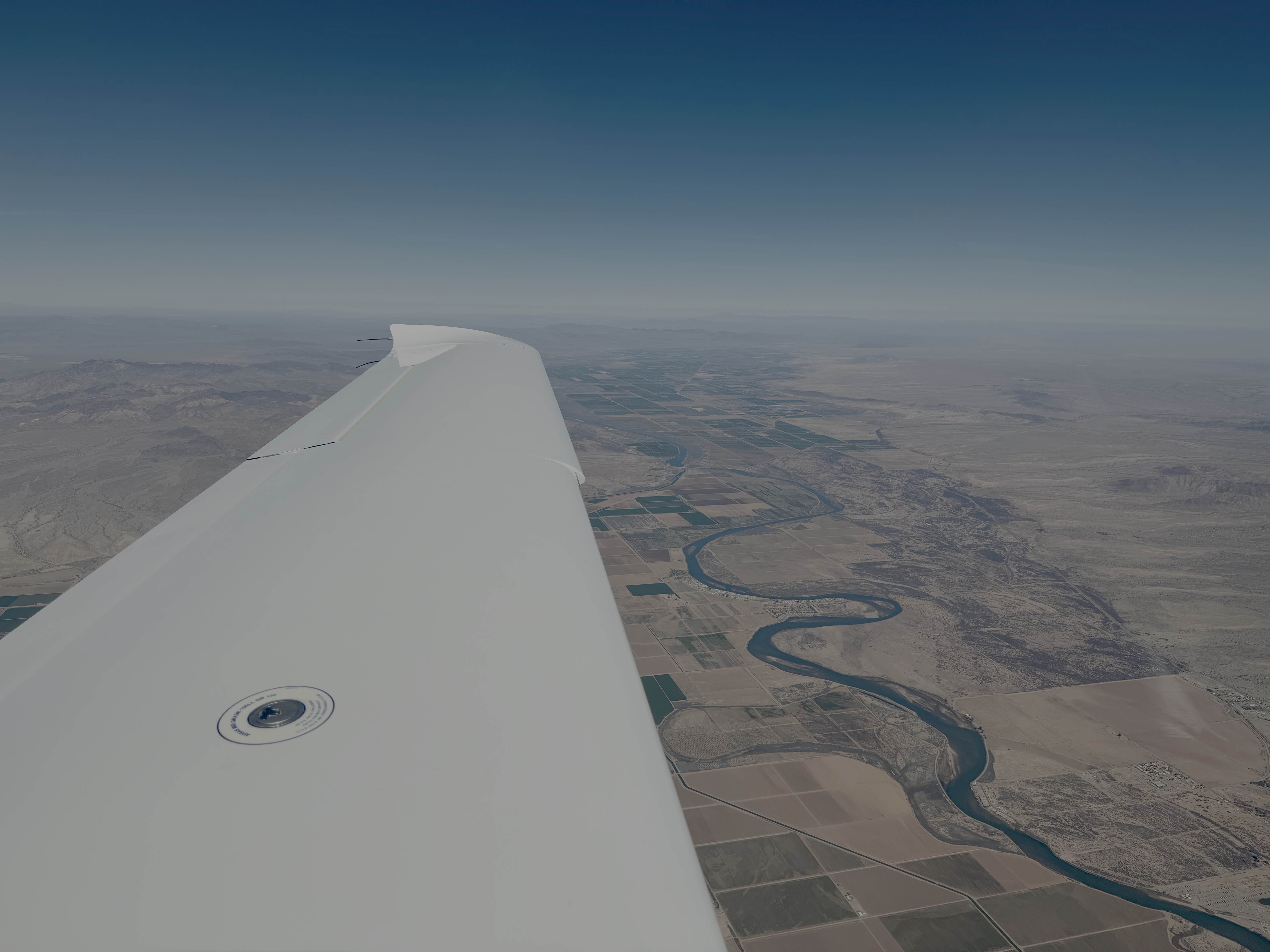
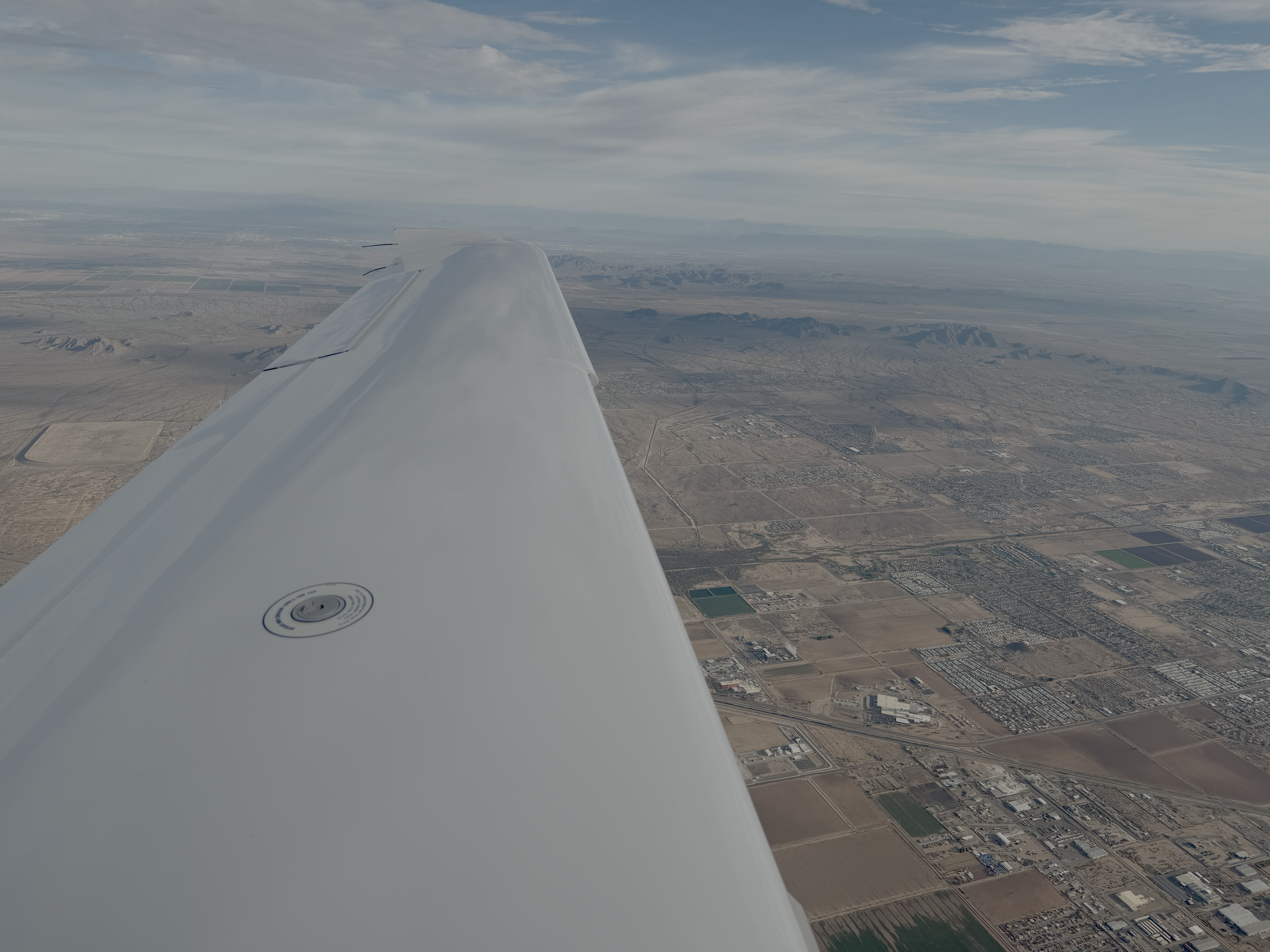
The trip from KBFL to KSDL started with a smooth rotation at 71 kts and then almost immediately transitioning from the OILDALE ONE departure to radar vectors and a slow climb to 9,000'. Once I got above 6,000' and clear of traffic on the ILS RWY 30R approach at KBFL, then Bakersfield Approach cleared me direct to PMD (Palmdale VOR) and a climb to 11,000'. Crossing the Tehachapi Mountains was fairly tame with no effects of mountain wave or really any turbulence at all, either during the climb or once the 11,000' MSL cruise altitude was reached. As I was approaching the Palmdale VOR (PMD), I was given an amendment to my IFR route, which was to head to the APLES waypoint via airway V386. In order to load the V386 airway, I had to delete the ARLIN4 arrival from the flight plan. Then I was able to put the cursor after PMD, then Menu to Load Airway pick to select V386.APLES. The purpose of the amendment was to route me around the military operation areas (MOA), which were hot. Prior to reaching APLES, I was given a second amendment to my IFR route, which was to head direct to BLH (Blythe VOR), and intercept airway V16 to BXK (Buckeye VOR). On the way to the Buckeye VOR, I was asked to descend from 11,000' MSL to 9,000' MSL, and then advised to plan my descent to arrive at the Buckeye VOR at an altitude of 7,000' MSL. Just prior to the Buckeye VOR, Phoenix Approach provided a heading, and then proceeded to vector me to the Visual RWY 21 approach into KSDL. The Visual RWY 21 approach consisted of directing me to a point 6 nm south of KSDL, and then to proceed to intercept left downwind runway 21. Upon landing on runway 21, I received progressive taxi instructions to exit the runway at B10 taxiway and turn left on taxiway B and turn right on taxiway B12 to enter into the Signature Aviation ramp.
- Departure: KBFL (Bakersfield, CA), field elevation: 510'
- Arrival: KSDL (Scottsdale, AZ), field elevation: 1,510'
- Hobbs Time: 3.1 hours
- Highest Flight Altitude: 11,000'
- Approach: Visual RWY 21
- Date/Time: 2026-02-21, 9:49AM (PST) to 1:41PM (MST)
- Fuel: $9.00 per gallon @ KSDL
- ForeFlight Track Log
Clearance #1
- C: KSDL
- R: OILDALE ONE, RV, ARVIN, V197, PMD, BLH, ARLIN4
- A: 6,000', expect 11,000' after 10 minutes
- F: 126.45
- T: 7312
Clearance #2
- C: KSDL
- R: PMD, V386, APLES, BLH, As Filed
Clearance #3
- C: KSDL
- R: POMTE, Direct BLH, V16, PXR, As Filed


2026-02-22: KSDL to KCNM
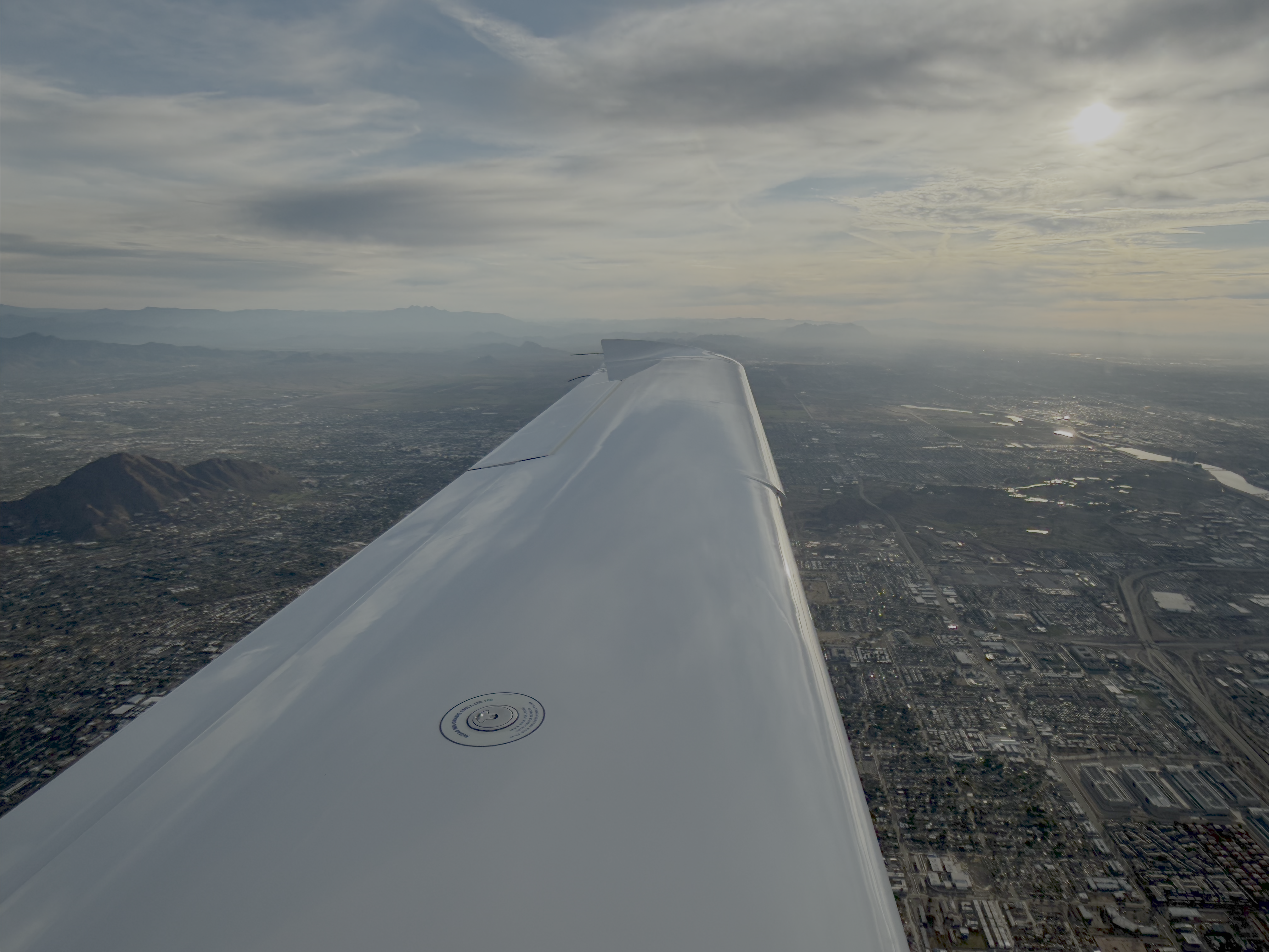
The second day started with Maricopa One Departure (MRRIC1.PXR) out of the Scottsdale Airport (KSDL), followed by radar vectors to a climb to a cruise altitude of 11,000' MSL.
- Departure: KSDL (Scottsdale, AZ), field elevation: 1,510'
- Arrival: KCNM (Carlsbad, NM), field elevation: 3,295'
- Hobbs Time: 3.8 hours
- Highest Flight Altitude: 11,000'
- Date/Time: 2026-02-22, 7:53AM to 11:23AM (MST)
- Approach: RNAV (GPS) RWY 14R
- ForeFlight Track Log
- C: KCNM
- R: MRRIC1, Radar Vectors, PXR, V105, TFD, V94, SSO, EWM
- A: 5,000', expect 11,000' after 3 minutes
- F: 120.7
- T: 4205


2026-02-22: KCNM to KTKI
After topping off our fuel, we departed almost immediately and headed to Dallas, TX on an IFR flight plan. The Dallas airspace was intense and crowded. Lone Star Approach wasn't always super clear on directions. Eventually they vectored us to join the RNAV (GPS) RWY 36 approach, and we landed to a full stop.
- Departure: KCNM (Carlsbad, NM), field elevation: 3,295'
- Arrival: KTKI (Dallas, TX), field elevation: 589'
- Hobbs Time: 3.4 hours
- Highest Flight Altitude: 9,000'
- Date/Time: 2026-02-22, 12:08PM (CST) to 3:16PM (CST)
- Approach: RNAV (GPS) RWY 36 @ KTKI
- Fuel: $7.44 per gallon @ KTKI
- ForeFlight Track Log
Clearance #1
- C: KTKI
- R: DYETT, WELCH, LBB115/069, BGTOE, SWVAY4
- A: 9,000'
- F: 135.875
- T: ----
Clearance #2
- C: KTKI
- R: KNEAD, SWVAY4.FRSTI
2026-02-22: KTKI to KMEM
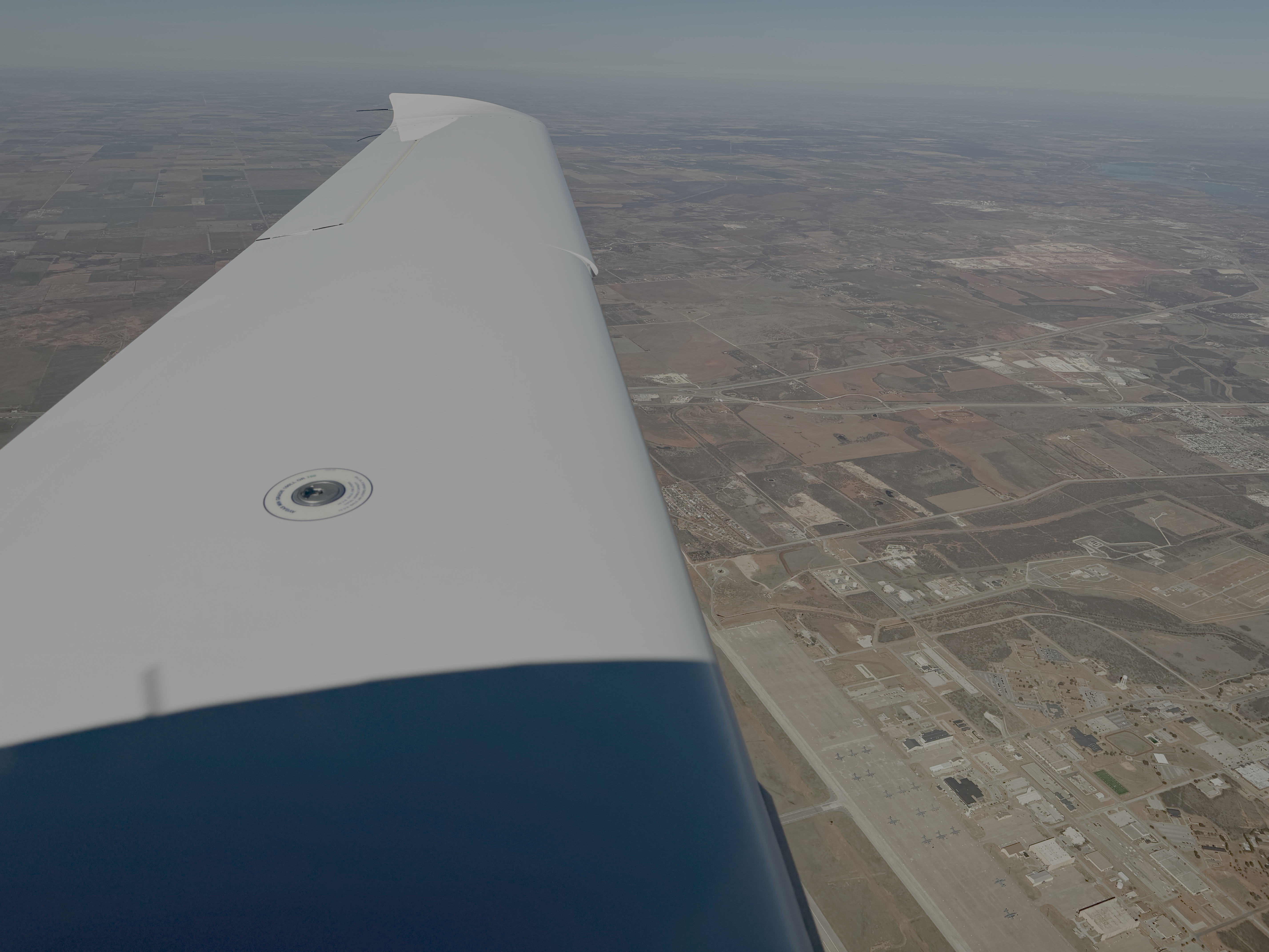
After stretching our legs a bit and topping off fuel, we hopped back in N977JW, and departed for Memphis, TN. As we were holding short of RWY 36, we got to see a Cirrus SF50 Vision Jet land. The flight to Memphis was flown at 11,000' MSL. The view was pretty hazy due to some fires in Arkansas, but eventually once it turned dark we could see the lights of towns/cities as we passed by. Landing at Memphis International (KMEM) at night was neat. We landed on RWY 36L after flying the ILS RWY 36L, then taxi'd to Signature Aviation and parked on their ramp. Upon opening the doors, we were greeted with the crisp Tennesee air, and we quickly put our jackets on, closed up N977JW, and headed inside.
- Departure: KTKI (Dallas, TX), field elevation: 589'
- Arrival: KMEM (Memphis, TN), field elevation: 341'
- Hobbs Time: 3.0 hours
- Highest Flight Altitude: 11,000'
- Date/Time: 2026-02-22, 5:01PM (CST) to 7:36PM (CST)
- Approach: ILS RWY 36L @ KMEM
- Fuel: $6.84 per gallon @ KMEM
- ForeFlight Track Log
- C: KMEM
- R: Radar Vectors, GARL6, TXK, As Filed (V16, PBF), RWY HDG
- A: 3,000', 11,000' after 10 minutes
- F: 124.3
- T: 0602


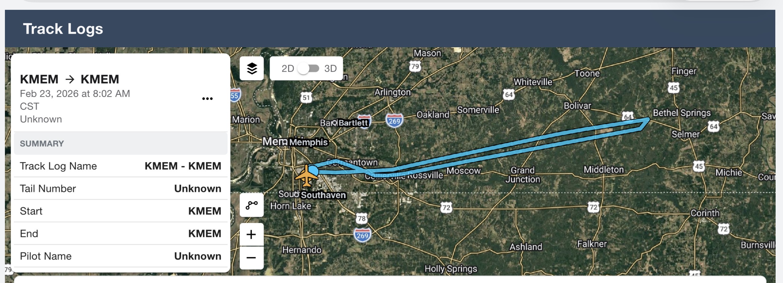
2026-02-23: KMEM to KTYS (KMEM)
On the last day of the trip, I checked the weather forecast, and it looked like we were going to be able to make it to Knoxville, TN with no issues. However, after departing KMEM during our climb to 11,000' I noticed there was a special observation at KTYS that indicated there was light snow. Reviewing PIREPs confirmed that SR22 pilots at nearby airports were experiencing light rime ice. After communicating with Cirrus at KTYS, we confirmed there was in fact snow on the ground, so I made the decision to return Memphis International. I requested an amendment to our clearance, and we headed back. I flew the RNAV (GPS) RWY 27 with a forward slip to a full stop landing. The winds were 350 @ 15 knots, but the landing was decent given the crosswind conditions. Fortunately, I was able to change our flight plans from departing KTYS via United to departing KMEM via United with relative ease, and rearrange the car service picking us up at SFO. Next up is figuring out how to get N977JW the remaining 2 hours to KTYS; hopefully with me not having to fly back to Memphis.
- Departure: KMEM (Memphis, TN), field elevation: 341'
- Arrival: KTYS (Knoxville, TN), field elevation: 986'
- Hobbs Time: 1.5 hours
- Highest Flight Altitude: 11,000'
- Date/Time: 2026-02-23, 8:02AM (CST) to 9:07AM (CST)
- Approach: RNAV (GPS) RWY 27 @ KMEM
- Fuel: $6.84 per gallon @ KMEM
- ForeFlight Track Log
Clearance #1
- C: KTYS
- R: ELVIS4, EONEE
- A: 3,000', 11,000' after 10 minutes
- F: 124.15
- T: 1034
Clearance #2
- C: KMEM
- R: Left Turn Direct MEM, Descend and maintain 6,000'

Cross Country Flight Statistics
- Total Cross Country Hobbs Time: 17.0 hours
- Total Cross Country Flight (Tach) Time: 15.2 hours
- Total Quarts of Oil Used: 1.5